Griffith, New South Wales
| Griffith New South Wales |
|||||||
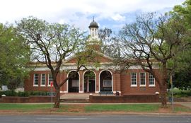 Griffith Court House |
|||||||
 Griffith
|
|||||||
| Population: | 16,182[1] | ||||||
| Established: | 1916 | ||||||
| Postcode: | 2680 | ||||||
| Elevation: | 129.2 m (424 ft) | ||||||
| Time zone:
• Summer (DST) |
AEST (UTC+10)
AEDT (UTC+11) |
||||||
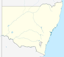
| Location: |
|
||||||
| LGA: | City of Griffith | ||||||
| County: | Cooper | ||||||
| State District: | Murrumbidgee | ||||||
| Federal Division: | Riverina | ||||||
|
|||||||
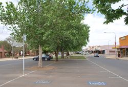
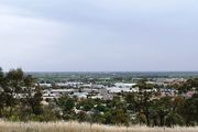
Griffith (pronounced /ˈɡrɪfəθ/[2]) is a city in south-western New South Wales, Australia. It is also the seat of the City of Griffith local government area. Like the Australian capital, Canberra and the nearby town of Leeton, Griffith was designed by Walter Burley Griffin. Griffith was named after Sir Arthur Griffith the first New South Wales minister of Public Works.[3] Griffith was proclaimed a city in 1987,[4] and presently has a population of 16,182.[1]
It can be accessed by road from Sydney and Canberra via the Hume Highway and the Burley Griffin Way and from Melbourne via the Newell Highway and either by using the Kidman Way or the Irrigation Way.
The city of Griffith had contained no traffic lights up until February 2010 when the first set of traffic lights were installed at the intersection of Burrell Place and Wakaden Street.[5][6]
Contents |
Demography
At the 2006 Census, 16,182 persons declared the urban centre locality of Griffith as their usual place of residence. Of this number 13,949 were Australian citizens. The median age was 34, and the average household size was 2.6 members.
2,857 persons were born overseas, of which 942 persons were born in Italy and 357 persons were born in India.
28% of persons declared themselves being of Australian ancestry, 19% English ancestry, 18% Italian ancestry, 6% Irish ancestry and 5% Scottish ancestry. Respondents could nominate up to two ancestries.[1]
History
Griffith was established in 1916 as part of the New South Wales State Government's Murrumbidgee Irrigation Area (MIA) project to supply irrigation from the Murrumbidgee river in western New South Wales to be used for farming.[4] The main dam was the large Burrinjuck Dam between Gundagai and Canberra, which stored water to be released down the river for irrigation. Yanco Weir, near Leeton, was built across the Murrumbidgee, from which flows the Main Canal. The Canal, almost a river in its own right, flows through the MIA to Griffith, supplying water to the entire area, and petering out to the northwest of the city in rice farms.
The water supply was further enhanced with the construction of the Snowy River scheme by the Australian Federal Government in the 1950s and 1960s. The Blowering Dam, a large dam near Tumut stores a significant amount of water to be released down the Murrumbidgee for irrigation around Leeton, Griffith and the newer Coleambally area south of the Murrumbidgee and Griffith.[4]
From the start of the MIA, citrus and other fruit and vegetables were grown in abundance around Griffith. In the 1950s the irrigation area expanded to include large rice farms. Vineyards were established early, and wineries followed, beginning with McWilliams wines at Hanwood and Yenda, two villages just outside the city.
From its earliest days, the MIA was populated by Italian workers, some of whom were initially employed by Australian farmers to run steamboats on the Murrumbidgee and Murray Rivers. Approximately 60%[7] of today's Griffith population claim Italian background. These include the initial settlement of Italians from the boat crews and other Italians who came out to Australia in the Depression, or from a second wave of immigrant Italians who came to Griffith in the late 1950s and early 1960s.
In the 1970s, Griffith was often associated with drug distribution (particularly marijuana) and organised crime,[8] as depicted in 2009 by Underbelly: A Tale of Two Cities. However, Griffith is now associated with good wine and food, primarily as a result of its diverse population, with notable contributions by Italian-Australians. Griffith's multi-ethnic population is now absorbing new national groups, including a significant Sikh Indian community.[9] The city is sister city with the Italian town of Treviso in the Veneto area. Many Italians in Griffith are from the Veneto region or the Calabria region of Italy.
The Italian influence expanded the range of fruit and vegetables, and also significantly increased the number of wineries and the range of wines produced. De Bortoli, Rosetto and other wineries were established by Italian immigrants, and today they are well known around Australia. In recent times they have been joined by one of the country's best known wine labels, Yellow Tail, produced by Casella Wines.
Griffith is the cathedral city of the Anglican Diocese of Riverina. The foundation stone of the Parish Church of St Alban the Martyr was dedicated in 1954. It was proclaimed as a cathedral in 1984.
Climate
Griffith has a semi-arid climate (BSk) under the Köppen climate classification.[10]
| Month | Jan | Feb | Mar | Apr | May | Jun | Jul | Aug | Sep | Oct | Nov | Dec | Year |
|---|---|---|---|---|---|---|---|---|---|---|---|---|---|
| Temperatures (°C) | |||||||||||||
| Mean daily maximum | 32.6 | 32.1 | 28.7 | 24.0 | 19.2 | 15.4 | 14.4 | 16.5 | 19.7 | 23.7 | 27.8 | 30.8 | 23.7 |
| Highest recorded maximum | 46.0 (23rd 2001) |
45.0 (1st 2006) |
42.0 (1st 2005) |
36.1 (4th 1986) |
28.6 (2nd 1978) |
25.0 (9th 2005) |
23.0 (26th 2007) |
30.0 (30th 2007) |
35.0 (22nd 2003) |
38.3 (30th 1990) |
43.0 (26th 1997) |
44.0 (21st 2005) |
|
| Lowest recorded maximum | 20.0 (16th 2005) |
13.0 (3rd 2005) |
16.4 (2nd 1987) |
13.4 (27th 1982) |
9.1 (31st 1990) |
8.0 (9th 1989) |
6.1 (3rd 1984) |
9.2 (8th 1987) |
10.6 (13th 1990) |
13.8 (3rd 1986) |
11.2 (7th 1971) |
16.4 (11th 1991) |
|
| Mean daily minimum | 16.6 | 17.2 | 14.1 | 10.1 | 7.2 | 4.4 | 3.4 | 3.8 | 5.8 | 8.8 | 12.3 | 15.0 | 9.9 |
| Highest recorded minimum | 30.0 (30th 2006) |
29.0 (28th 1987) |
30.0 (27th 1990) |
24.0 (10th 2005) |
18.0 (13th 1997) |
17.0 (4th 1996) |
14.1 (31st 1975) |
17.0 (31st 2007) |
20.0 (24th 2001) |
23.0 (13th 2006) |
26.0 (30th 2004) |
29.3 (21st 1994) |
|
| Lowest recorded minimum | 6.8 (13th 1975) |
7.6 (7th 1980) |
4.2 (28th 1984) |
0.0 (23rd 2006) |
−2.0 (30th 2006) |
−4.8 (22nd 2007) |
−5.9 (17th 1977) |
−3.0 (17th 2000) |
−2.0 (28th 2003) |
−0.6 (15th 1970) |
1.8 (4th 1974) |
4.2 (4th 1978) |
|
| Precipitation (millimetres) | |||||||||||||
| Mean total rainfall | 32.8 | 26.4 | 33.8 | 28.7 | 36.5 | 33.3 | 34.3 | 36.8 | 33.9 | 40.1 | 32.8 | 31.6 | 400.9 |
| Highest recorded total | 257.1 (1984) |
138.2 (1977) |
216.8 (1989) |
170.2 (1974) |
136.0 (1978) |
70.4 (1987) |
88.4 (1981) |
87.6 (1974) |
116.1 (1970) |
143.0 (1976) |
128.0 (1971) |
127.8 (1992) |
660.2 (1979) |
| Lowest recorded total | 0.0 (1994) |
0.0 (1991) |
0.0 (1998) |
0.5 (1967) |
1.2 (2006) |
0.3 (1984) |
1.1 (1979) |
2.2 (2006) |
2.2 (2007) |
0.0 (2006) |
0.0 (1982) |
0.0 (1979) |
148.8 (2006) |
| Highest daily rainfall | 95.0 (1st 1984) |
41.8 (22nd 1977) |
149.8 (20th 1985) |
44.4 (21st 1990) |
51.9 (30th 1979) |
29.0 (20th 1969) |
32.8 (25th 1993) |
30.0 (24th 2003) |
35.2 (27th 1978) |
59.0 (21st 2005) |
45.7 (9th 1966) |
49.0 (5th 1992) |
|
| Notes: Temperatures are in degrees Celsius. Precipitation is in millimetres. Griffith Airport Latitude: -34.25°S Longitude: 146.07°E Elevation: 134 m ASL | |||||||||||||
Commerce
Griffith is the regional service centre for the vast Murrumbidgee Irrigation Area - one of the most productive agricultural regions in Australia.[11] Thanks to irrigation Griffith is rich in agriculture and the city is also known as Australia's "Wine and Food Country".[12]
Commercial
Griffith has experienced strong commercial growth in recent years. Griffith's main streets are Banna Avenue and Yambil Streets but commercial growth has occurred throughout the city. Shopping centre developments include:
- Griffith City Plaza
- Griffin Plaza
- Griffith Central
- Griffith Lifestyle Centre
- The Gateway Centre
- Griffith Woolworths Complex
- Griffith City Central
- Driver Shopping Complex
Industrial
Griffith is home to the Riverina's largest employer, the Baiada Group.[13] Griffith also has several wineries, including De Bortoli Wines and Casellas (makers of Yellowtail wine); and the Summertime Juice Factory.
Residential
Griffith's urban sprawl is very extensive due to the rapidly growing population. The entire suburb of Collina has been constructed to the north west of the city. Other housing development has occurred in North Griffith, Mayfair and Pioneer.
Education
Griffith is the third largest centre for education in the Riverina after Wagga Wagga and Leeton. Griffith is home to three high schools:
- Wade High School
- Griffith High School
- Marian Catholic College (formerly Catholic High School)
Griffith also has 13 primary schools and various day care and pre-school facilities. Griffith has one of the largest campuses of Riverina Institute of TAFE. There has been recent plans to construct a fifth campus of Charles Sturt University in Griffith.
Transport
Griffith Buslines operates buses through Griffith and surrounding towns And villages.
Griffith is a major junction for the Kidman Way, Burley Griffin Way and Irrigation Way. Griffith is located 550 km west of Sydney via Burley Griffin Way and Irrigation Way and 450 km north of Melbourne via the Kidman Way. Griffith has daily bus services to the major metropolitan areas and a special Xplorer service to Sydney on weekends. Griffith Airport operates daily flights to Sydney and Melbourne.
| Preceding station | CountryLink | Following station | ||
|---|---|---|---|---|
| Terminus | CountryLink Southern
Griffith Xplorer
|
Leeton
towards Sydney
|
||
The railway reached Griffith on 3 July 1916 and since that date has provided an excellent service in transporting passengers and goods into and out of the area. Regular goods trains continue, making it a unique railway centre.[14]
Events
- Riverina Field Days, which is held annually in May.
- La Festa, Wine, Food and Multicultural Festival, which is held annually over the Easter weekend.
Attractions
Griffith has many tourist attractions. These include Pioneer Park, a 510 seat Regional Theatre, the Italian museum, the Griffith Regional Art Gallery, craft and antique shops, and its many high standard restaurants. Many of the Griffith wineries also have wine tasting at the cellar door, notably De Bortoli Wines, McWilliams, Beelgara Estate (formally Rossetto Wines), West End Wines, Miranda Wines and Riverina Wines. Griffith is famous for its botrytis including Debortoli's Noble One and its fortified wine such as McWilliams' Hanwood Port. Ecotourism is also available in Griffith. Scenic Hill has various walking trails, lookouts and is home to the famous Hermit's Cave. Nericon Swamp is one of only 40 world listed habitats for migratory birds. Nearby Cocoparra National Park offers walking trails and there are opportunities to explore along the Murrumbidgee River and Lake Wyangan.
Notable people
- Evonne Goolagong, former World No. 1 Australian female tennis player.
- Donald Mackay, anti-drugs campaigner.
- Phillip Noyce, director of the 2002 film Rabbit-Proof Fence and the 2010 American film Salt.
- Robert Trimbole, Italian-Australian drug baron, organised crime boss and businessman.
See also
- Donald Mackay
- Phillip Noyce
- Robert Trimbole
- Valerio Ricetti
Notes and references
- ↑ 1.0 1.1 1.2 Australian Bureau of Statistics (25 October 2007). "Griffith (Urban Centre/Locality)". 2006 Census QuickStats. http://www.censusdata.abs.gov.au/ABSNavigation/prenav/LocationSearch?collection=Census&period=2006&areacode=UCL136000&producttype=QuickStats&breadcrumb=PL&action=401. Retrieved 29 June 2008.
- ↑ Macquarie ABC Dictionary. The Macquarie Library Pty Ltd. 2003. p. 430. ISBN 0 876429 37 2.
- ↑ Australian Dictionary of Biography entry for Griffith, Arthur Hill (1861 - 1946)
- ↑ 4.0 4.1 4.2 "History of Griffith". Griffith City Council. http://www.griffith.nsw.gov.au/Page/Page.asp?Page_Id=620. Retrieved 2008-08-16.
- ↑ Tyson, Ross (28 March 2008). "Council says no to lights". The Area News (Fairfax Digital). http://griffith.yourguide.com.au/news/local/general/council-says-no-to-lights/1211794.html. Retrieved 8 April 2008.
- ↑ Tyson, Ross (5 February 2010). "Busy intersection lights up". The Area News (Fairfax Digital). http://www.areanews.com.au/news/local/news/general/busy-intersection-lights-up/1743533.aspx. Retrieved 6 February 2010.
- ↑ "Italian Story". Australian Broadcasting Corporation. 2004. http://www.abc.net.au/stateline/nsw/content/2004/s1197534.htm.
- ↑ "Aussie Bob, the panel beater who became a millionaire". The Age. 1983-05-16.
- ↑ "Sikh community continues tsunami relief efforts". ABCNews. 4 January 2005. http://www.abc.net.au/news/stories/2005/01/04/1276016.htm.
- ↑ Linacre, Edward; Geerts, Bart (1997). Climates and Weather Explained. London: Routledge. p. 379. ISBN 0-415-12519-7. http://books.google.com.au/books?id=mkZa1KLHCAQC&lpg=PA379&pg=PA379#v=onepage&q=&f=false.
- ↑ "Sustainable Agriculture in the Lower Murrumbidgee Catchment". European Geosciences Union. Institute of Hydromechanics and Water Resources Management. http://www.cosis.net/abstracts/EGU05/07492/EGU05-J-07492.pdf. Retrieved 10 October 2008.
- ↑ "Vacations Griffith - Australia". www.placesonline.com. http://www.placesonline.com/oceania/australia/new_south_wales/griffith/introduction.asp. Retrieved 2010-02-28.
- ↑ "Union fears more Baiada job cuts". www.abc.net.au. July 31, 2009. http://www.abc.net.au/news/stories/2009/07/31/2642018.htm. Retrieved 2010-02-28.
- ↑ From Penfolds to Patricks Pollard, Neville Australian Railway History, February; March; April, 2008 pp39-57; 75-89; 111-117
|
|||||||||||
|
||||||||||||||||||||||||||